Cotswolds
Cotswolds Nature Walk
Hilltop trails and tower climbs with panoramic views across the Cotswold escarpment.
Day
6h 35m
140 min drive
4 stops
nature
walk
history
village
parking
dog-friendly
free-entry
kids-friendly
See full route with map →
Listen to the audio guide
Enter your email to unlock the full audio guide for this route.
Stops on this route
1
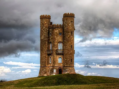
Folly tower on the second-highest point in the Cotswolds with views across 16 counties.
1h
Parking available
Climb to the top for views on clear mornings.
Book tickets
£10-£21
nature
walk
history
parking
dog-friendly
2
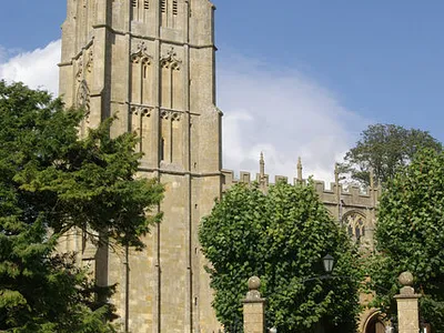
One of the finest wool towns in the Cotswolds, with a magnificent Perpendicular church and curved High Street.
1h
Parking available
Start or end point of the Cotswold Way.
village
history
free-entry
parking
3
Stow-on-the-Wold
Reveal the full route to see details, photos and driving times.
4
Bourton-on-the-Water
Reveal the full route to see details, photos and driving times.
2 more stops on this route
See every stop, the interactive map and driving times.
Reveal full route →More day trips near Cotswolds
Want to see routes tailored to your starting location?